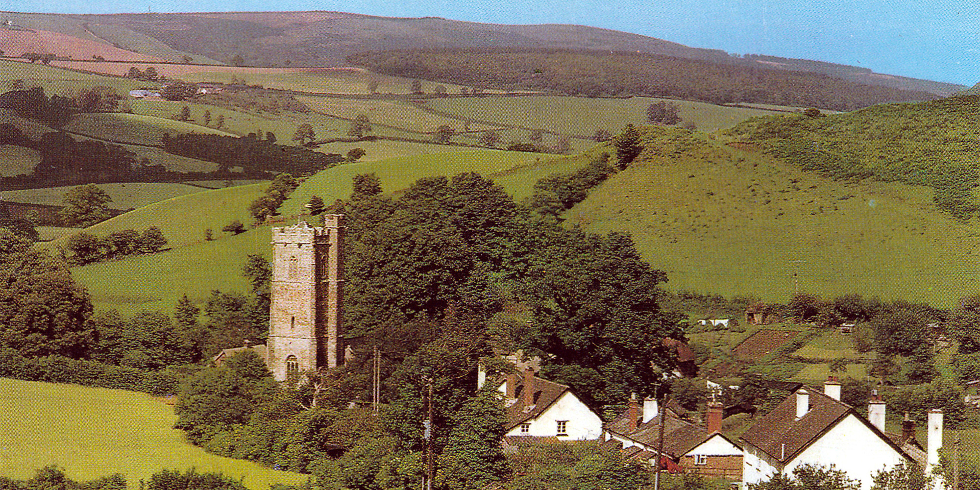
This month I have chosen a picture postcard image taken either from the field at the top of Stoney Street or from the lane running alongside (we always called it Hill Hedges) that emerges at Chapel Cross. The picture dates from the mid-1950’s and gives particularly good views of Knowle Top (Iron Ore), and the gardens belonging to Glebe Farm (with a line of washing) and the School House. Just to the right of the washing line against the hedge is the small stone building in which my uncle kept his ferrets and garden tools. This was the pre-myxomatosis era and rabbits were plentiful.
My main reason for choosing this picture is actually because of something that is almost invisible and may be taken for a printing flaw. It shows a structure located not in Luccombe Parish, but in what then was the parish of Minehead Without that had a very brief lifespan and little information recorded about it.
At the end of the Second World War, defence structures were quickly decommissioned. This included most of the country’s radar installations. One of these was located on Minehead’s North Hill, near the Tank Ground, the main building of which still exists and is sometimes opened to the public. The rapid escalation of the Cold War in the 1950’s meant that a new radar network known as ROTOR had to be rapidly constructed using what was basically outdated WW2 technology. One of the locations chosen by the Air Ministry for one of these ROTOR stations was also on North Hill, near the site of a deserted farmstead called West Myne.

This entire area is owned by the National Trust who initially refused permission to build the radar station on their land. The Air Ministry insisted and eventually, the National Trust relented on condition that the Royal Arts Commission approved the design. They imposed numerous conditions relating to the appearance and positioning of the buildings. The County Council was also involved in granting planning permission resulting in a prolonged consultation period.
By April 1956 RAF West Myne was almost complete with a Type 14 radar on a 35’ gantry and a Type 13 height finder on a 9’ plinth. The station was equipped with 6 Type 60A consoles, 1 Type 61 console and 2 video map units. Remote VHF transmitter and receiver blocks were provided; both were at Bratton Ball 1 1⁄4 miles south east of the technical site. No domestic camp was provided, with personnel being billeted in hotels in Minehead.
By the target completion date of April 1956 some ROTOR stations had already closed down and the introduction of a much more efficient system had no place for West Myne. Despite the large outlay, the station had a very short – if any – operational life. After closure the buildings were quickly demolished and today the only evidence is the road that led to the site and a large flat area about 35 metres in length which was the site of the main building. There is also an area of concrete that is probably the base of one of the ancillary buildings.
Looking at the postcard, the items of interest, indicated by the top arrows, are two faint vertical lines on the horizon at Bratton Ball. These were the remote VHF aerial towers referred to above. Looking carefully at a magnified image, the second tower is barely visible and I actually failed to notice it until I was preparing this article. Both masts may be difficult to see on the website image. At the time that RAF West Myne was being built, I was attending primary school in Minehead, and can vividly remember seeing these two towers ‘growing’ day by day. I have seen one picture postcard showing these towers, but that was probably 40 years ago. Needless to say I have never seen one since or for sale, but I would love to hear if anyone has one. I never viewed the RAF West Myne buildings before their demolition and to my knowledge, only one photograph exists, the aerial view that is also shown here.

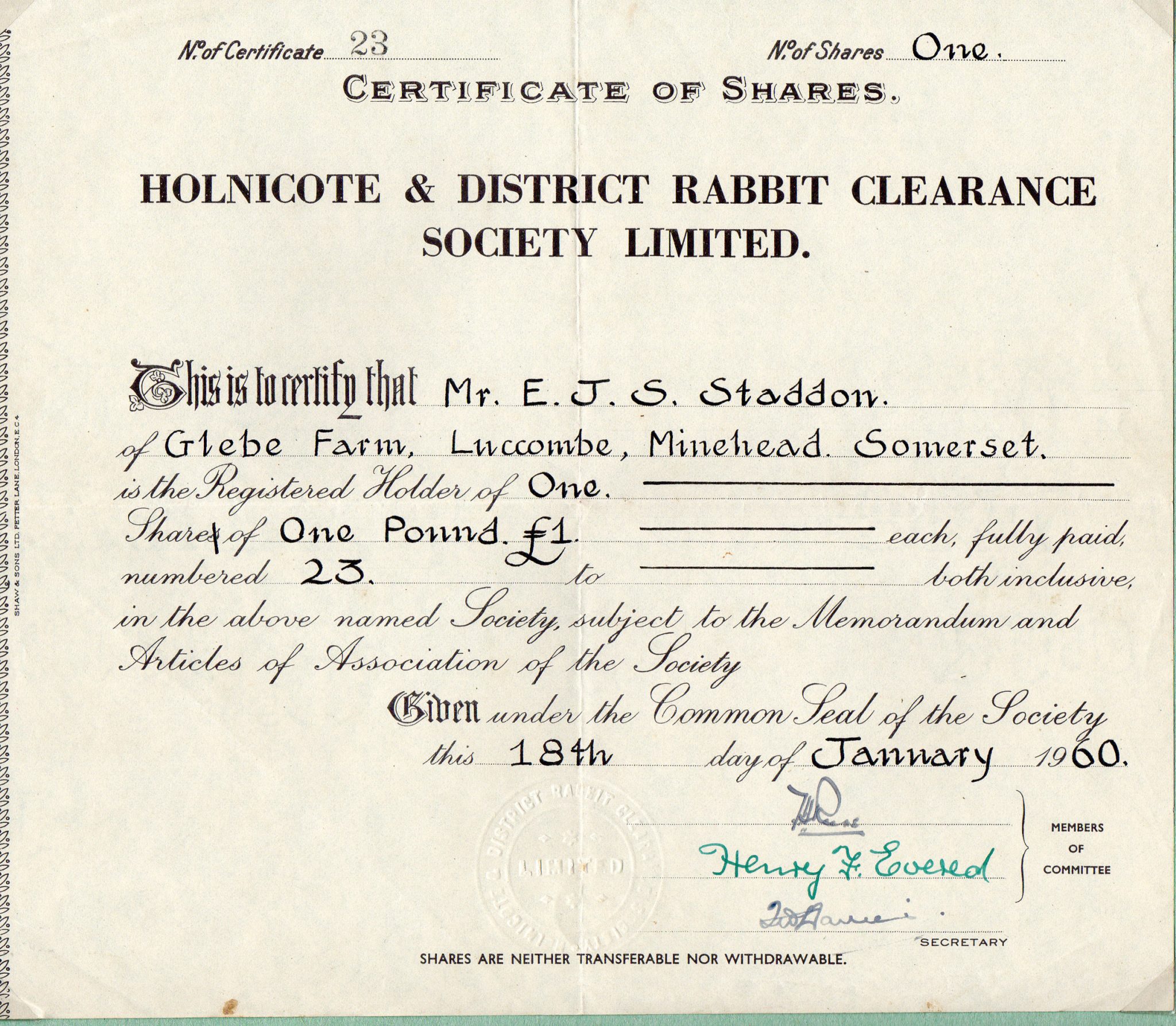
My other images are more down to earth (sorry!) and relate to the ferrets in Edward Staddon’s garden. The first is a share certificate for the Holnicote and District Rabbit Clearance Society. Amongst other things, membership enabled shotgun cartridges to be bought at special rates in an attempt to completely eradicate the rabbit population following myxomatosis.
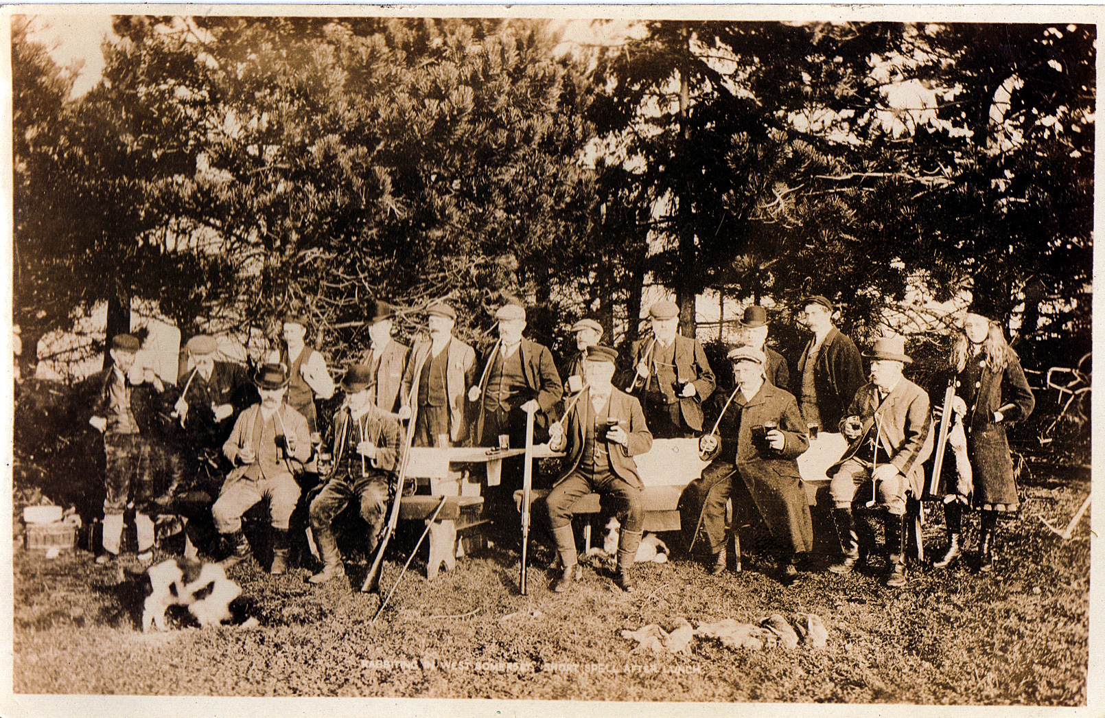
The second is a delightful picture postcard by Alfred Vowles titled “Rabbiting in West Somerset, short spell after lunch”. Almost everyone (except the young lady on the right) is smoking very long ‘churchwarden’ pipes.
For more information on RAF West Myne, visit the Subterranea Brittanica website.
See our previous pictures of the month and other posts about local history here.
Leave A Comment